The system for consulting LPR records in the Surveillance Client has integration with Google Maps, making it possible to display all the recognition points of a license plate on the map, simply by registering the GPS position of the LPR cameras.
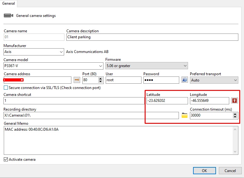
First of all, the cameras configured to generate LPR readings must have their coordinates configured. See the Administration Client Manual to learn how to configure the coordinates:
The screen for plotting the LPR route will display all the points at which the license plates reported in the search were found in the specified period and will link the points by time, and it is also possible to use the Google Maps route engine and plot a route between the recognized points, however for this feature to work correctly it is necessary for the license plate to have been recognized on several cameras to generate greater route accuracy. This is an excellent feature for LPR installations in smart cities.
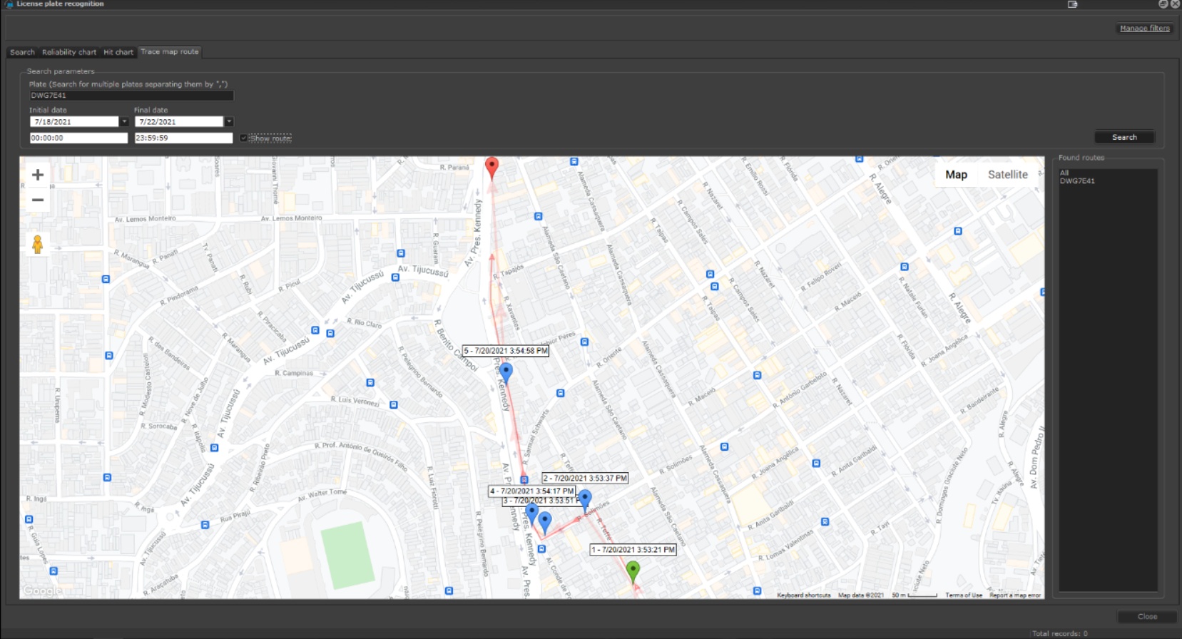
The records will be saved in the system database, and the Latitude and Longitude data from the cameras that generated the record will be accompanied by the times at which the vehicle was detected. From this data, the Surveillance Client is able to plot the vehicle's route on a Google Maps map.
Click on the Trace Map Route tab:

•License Plate: Enter the license plate number to be located. You can consult multiple license plates by entering each license plate separated by a comma.
•Start and End Date: Times and days to be searched.
•Show Route: Based on the times and places where the license plate was detected, the system calculates the route taken by the vehicle and displays it on the map screen.
•Routes Found: After the search, the license plates located will be added in the Found Routes column. Click on the license plate you want to see its route or select All to see all the routes for all the license plates simultaneously.