To add Operational Maps, in your Administration Client, search for the Operational Maps item and click on Maps:
![]()
The Operational Map Registration screen will be displayed:
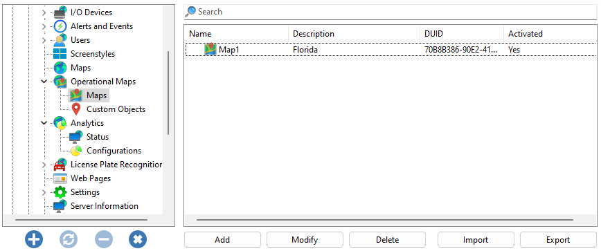
Click Add to add a new map.
To change an already registered map, select it and click Modify, and change the data as explained on the following pages.
To remove a map, select the desired map and click the Remove button.
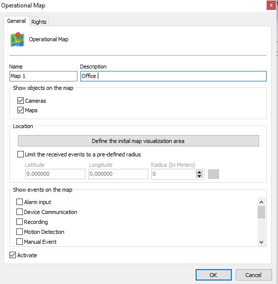
•Name: Name of your Operational Map.
•Description: Description of your Operational Map.
•Show Objects on the Map: Select which objects should appear on the map, between Cameras and Internal Synoptic Maps.
Location
•Define the intial map visualization area: Defines the starting point for displaying the map on the screen, e.g.:

On this map screen you must adjust the map to your starting position. The position where you leave it will be loaded into the Surveillance Client when the operator puts this map on screen.
•Limit the received events to a pre-defined Radius: Determines an area of the map, in Latitude, Longitude and Radius, where events triggered by the system will only be displayed on the map if they are within the defined radius.
•View Events on the Map: Filter to determine what type of event will be displayed on the map.
|
|---|
You must configure Google Maps integration in Server Settings. See the Google Maps Configuration topic for more information. |